Getting from A to B used to involve hauling around a map, asking for directions, and occasionally getting lost. Nowadays, many new cars have built-in navigation systems, often with voice-activated capability and seemingly endless capabilities when it comes to wayfinding, points of interest, traffic-condition awareness, and predicting arrival times.
You may not have heard of it, but one of the world’s first navigation systems was born from a collaborative effort between Alpine, Honda, and Stanley Electric. It was called the Electro Gyro-Cator, and it was offered in 1981 as an option on the Honda Accord and Vigor models in the Japanese market. (The price by the way, at 300,000 Yen, was about one-fourth the value of the car).
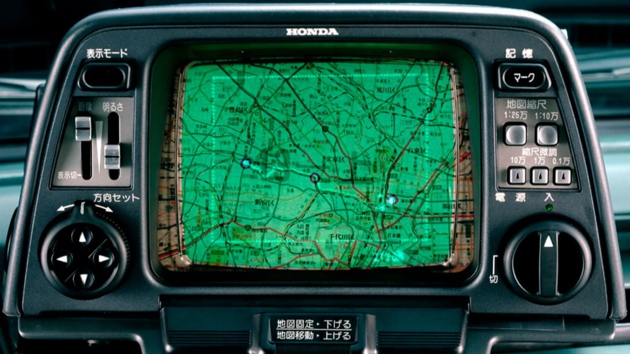
The Electro Gyro-Cator contained a helium gas gyroscope that was used to detect acceleration and rotation. There were transparent maps inside the unit that would scroll across a six-inch CRT screen. Pretty wild to think of the innovation that that took to put together! For deeper reading, here’s a Honda-produced summary on the development of the Gyro-Cator and its impact.
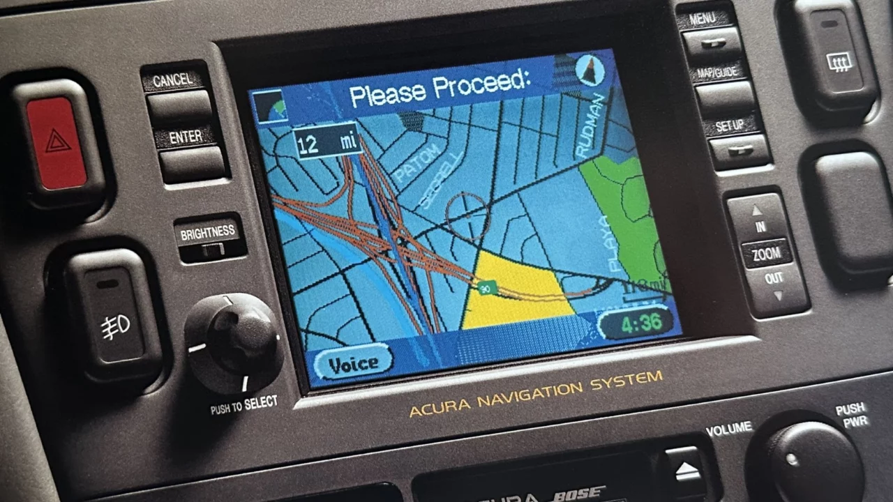
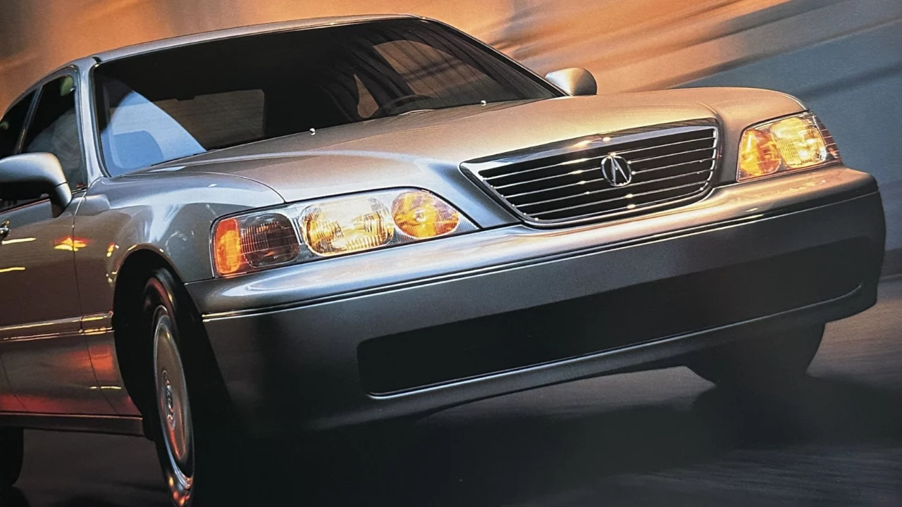
As it turns out, Honda was once again on the leading edge of navigation systems about 15 years later. In 1995, the company rolled out a new satellite-linked, hard disk-based navigation system on the 1996 flagship model of its upscale Acura division, the 3.5 RL.
Acura said at the time, “Driving the Acura RL says you’ve truly arrived. And with the Acura satellite-linked navigation system, it can even tell you how to get there.”
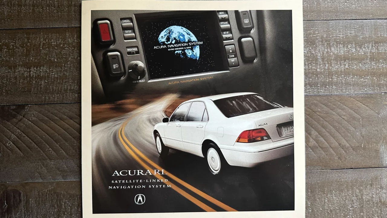
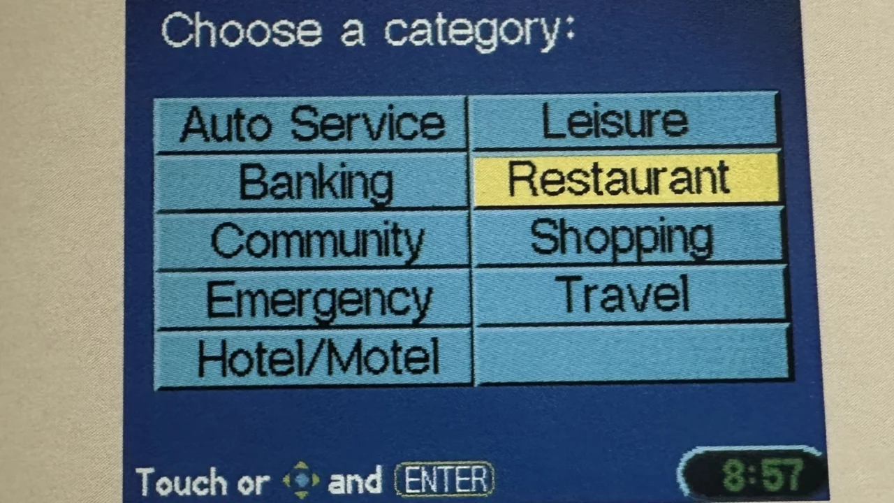
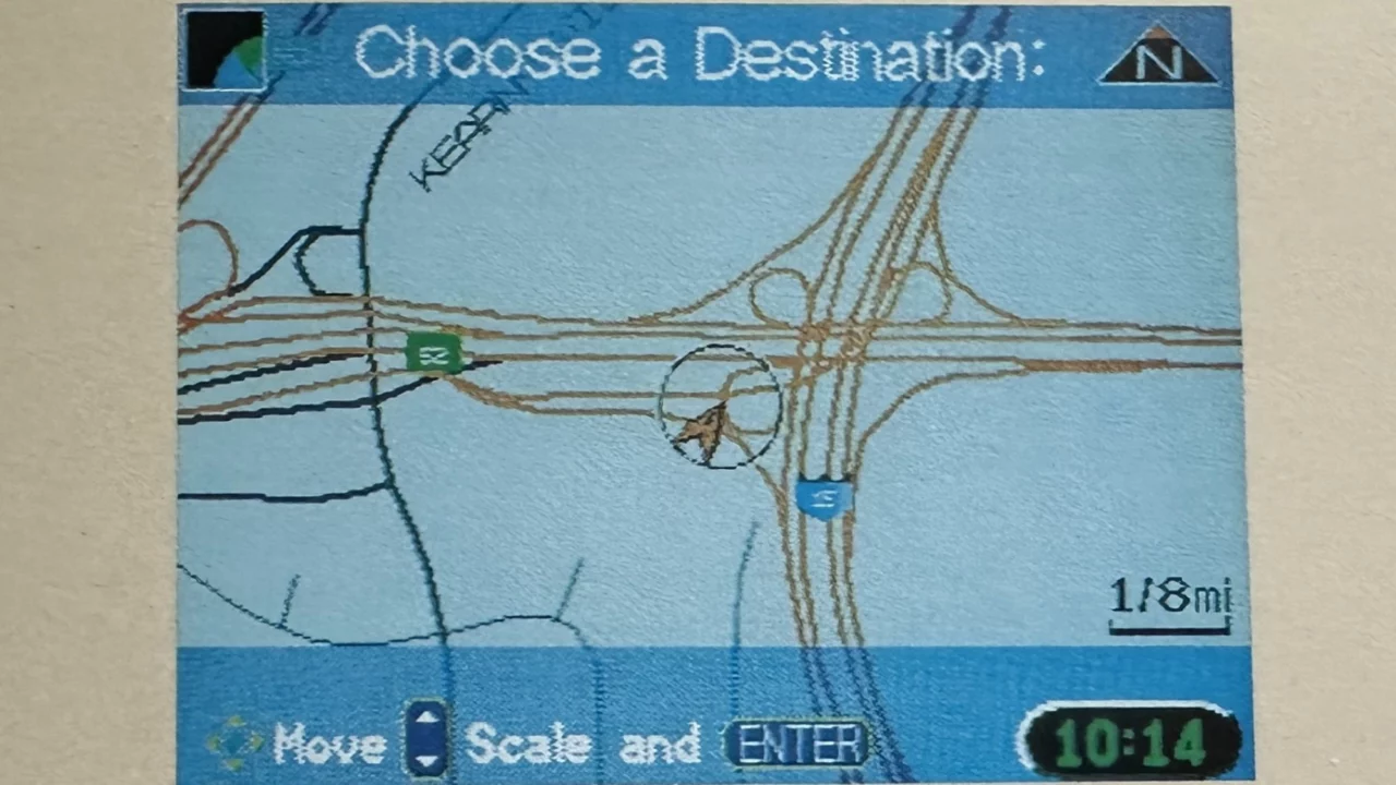
The RL’s navigation system was such a proud achievement for Acura that it had its own promotional brochure. Among the system’s noted features were:
- Global Positioning System (GPS) receiver
- Electronic gyroscopic inertial navigation and vehicle speed sensor (a throwback to the 1981 invention)
- Built-in, dashboard-mounted Liquid Crystal Display (LCD) with touchscreen and joystick controls
- Programmed voice instruction
- Address, intersection, places, previous destination, and map input
- Memory of the last 20 destinations entered
- Guidance for dealerships, banks, police, hospitals, restaurants, and malls
- Off-route recalculation – in case you strayed off-course
- Personal address storage (up to 100)
- Road type options (minimizing freeways, minimizing toll roads, etc.)
Here are a couple images showing what the RL’s navigation interface looked like:
Today, many people rely on smart phones for navigation, as opposed to taking the time to plug destinations into a vehicle’s built-in system. And with connectivity features like Apple CarPlay, the gap between mobile mapping and car-based mapping is even more seamless than ever before.
Are you still old-school when it comes to printing maps or directions? I have memories of using websites like MapQuest for generating turn-by-turn directions in the 1990s, and admittedly there was something special about following a trip’s progress on an actual paper map instead of just tracking movement on a digital screen. I wonder what navigation systems will look like 30 more years from now.
